Division of Research & Innovation
TDOT Funds Development of Statewide Land Use Model
Tennessee Statewide Land Use Model Enhancements with Local Validation and Implementation
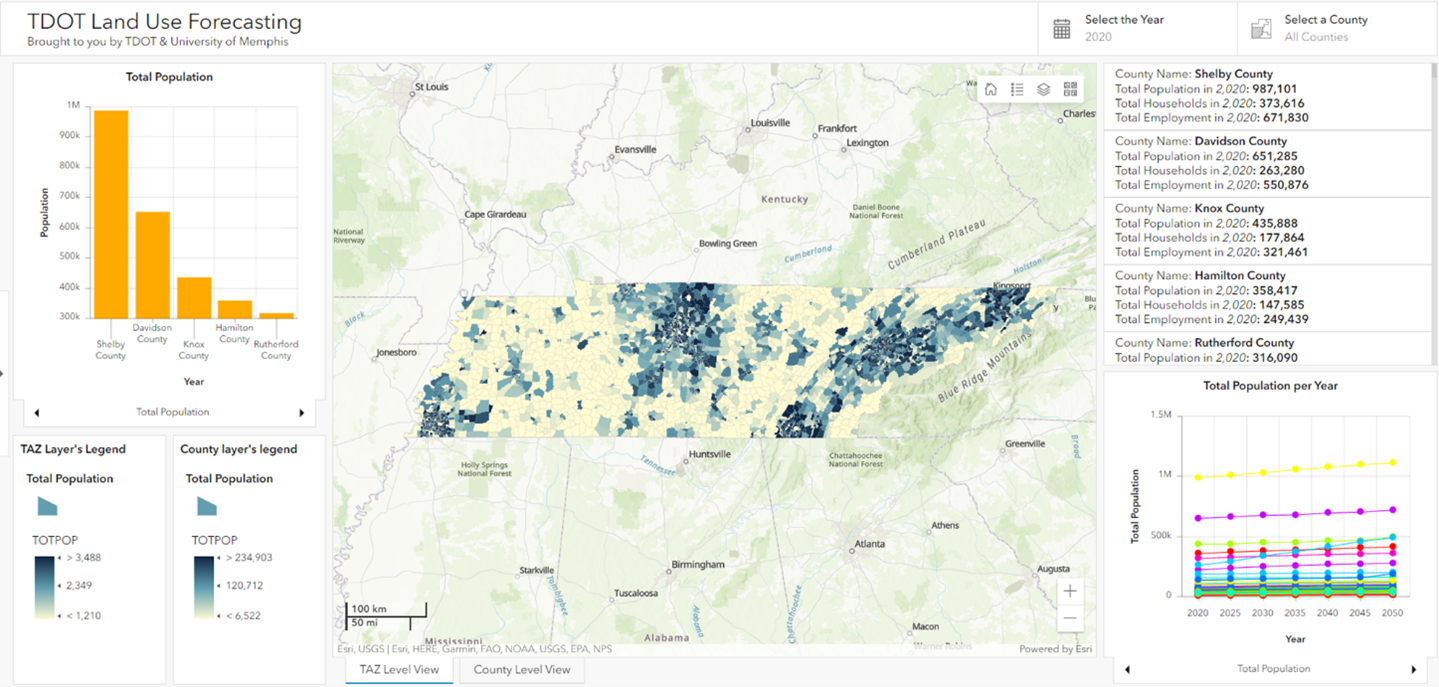
The Center for Transportation Innovations Education and Research (C-TIER) at the University of Memphis was awarded a project by the Tennessee Department of Transportation (TDOT) to develop a statewide land use model which can be used for future land development and roadway planning. In 2021 Dr. Sabya Mishra and Dr. Mihalis Golias, both in the Department of Civil, Construction, and Environmental Engineering at the University of Memphis, developed a first of its kind statewide land use model for Tennessee and the results can be viewed in an open-access online dashboard (link). This is one of its kind of a land use model in the country.

 The work includes extensive data collection, including parcel data, employment data,
and accessibility data. As a part of this work, C-TIER researchers collected all 95
county land use and parcel data, along with other land attribute data. The primary
objective was to develop a comprehensive land use model capable of providing both
current and future land use attributes at a statewide level. The model's accuracy
was rigorously validated at the county level, but now we're taking it to the next
level.
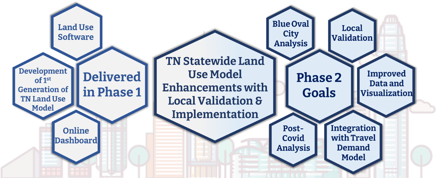
In the second phase of the project, we are focused on refining and enhancing the model by conducting local validation and implementing crucial improvements:
- Local Validation: We are collaborating with various Metropolitan Planning Organizations (MPOs), Regional Planning Organizations (RPOs), and Transportation Planning Organizations (TPOs) to ensure that the land use model aligns with local data and needs.
- Improved Data and Visualization: Our aim is to enhance the accuracy of the model by improving data sources and output visualization, making it more accessible and informative.
- Integration with Travel Demand Model: We are integrating the statewide land use model with the Tennessee Statewide Travel Demand Model v4 to create a more comprehensive and powerful tool for urban planning.
- Blue Oval City Analyses: the development of Ford's mega battery and vehicle manufacturing campus in Blue Oval City, TN, will change both the land use and transportation conditions of the state of Tennessee. Hence, one of the goals of this project is to forecast these changes and propose guidelines and policies for future development of the transportation system.
- Post-Covid Analysis: In light of the COVID-19 pandemic, we are adding analyses that account for post-pandemic changes in land use and transportation patterns.

This project offers governments and agencies a powerful tool to align urban planning with environmental sustainability. The outputs promote transit-oriented development, reduce automobile reliance, and help mitigate greenhouse gas emissions, contributing to a healthier urban environment. Additionally, they enhance disaster preparedness and resilience planning, crucial in a world facing increasing climate-related challenges. For the public, the benefits are substantial, including reduced travel times, lower commuting costs, and improved access to jobs and services. This research enhances the quality of life, especially for marginalized communities, by providing accurate predictions about future land use trends. It enables cities to adapt and create more livable and inclusive urban spaces. Ultimately, this project benefits governments, agencies, and the public, driving positive transformation toward sustainable, resilient, and equitable communities.
For more information on this project, contact Mishra at smishra3@memphis.edu.
