Division of Research & Innovation
Enhancing USGS Seismic Hazard Maps for the Coastal Plain Region
Adjusting CEUS Ground Motion Models for Use in Coastal Plain Considering the Sediment Thickness
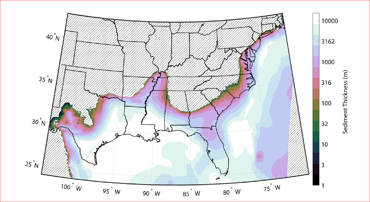
The Atlantic and Coastal Plains (ACP) of the United States, referred to as “Coastal Plain,” shown with a solid line, possess site conditions systematically different from those elsewhere in eastern North America. The geographic variation of the thickness of Cretaceous and younger Coastal Plain sediments ranges from zero to more than 15 km in the Coastal Plain.
Dr. Shahram Pezeshk, director of Center for Disaster Recovery and Resiliency and professor of Civil Engineering, recently received a grant from the U.S. Geological Survey (USGS), for his project, “Adjusting CEUS Ground Motion Models for Use in Coastal Plain Considering the Sediment Thickness.” The objective of this research is to answer the following questions: (1) Are the predictions of the Next Generation Attenuation (NGA-EAST) Ground Motion Models (GMMs) different concerning the Central and Eastern United States data in Coast Plain (bias) and (2) if so, how to correct this bias. As part of this study, we will develop a set of adjustment factors as a function of the sediment thicknesses. Then, we can use the developed adjustment factors with existing GMMs developed for site conditions found outside the Coastal Plain to predict linear response spectral amplitudes with Coastal Plain sites over the full range of Coastal Plain sediment thicknesses.
Impact of this research
Pezeshk’s ground motion models for Central and Eastern North America (Shahjouei and Pezeshk, 2016 and Pezeshk et al., 2018, 2021, 2024) have been adopted by the United States Geological Survey (USGS) to develop hazard maps. These seismic hazard maps are used for the seismic design of all buildings and bridges in the Central and Eastern United States. This new project will enhance USGS seismic hazard maps for the Coastal Plain region.
For more information, contact Pezeshk at spezeshk@memphis.edu.

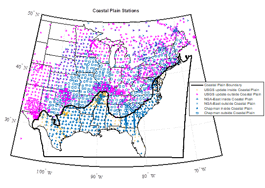
Distribution of the different earthquake recording stations.

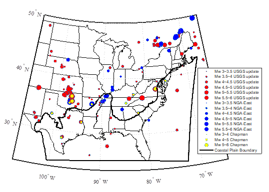
Location and size of earthquake events considered.

Composite sediment thickness map in meters across the Atlantic and Gulf Coastal Plains. The hatched area is outside of the Coastal Plains or undefined (Boyd et al, 2023).
