CERI
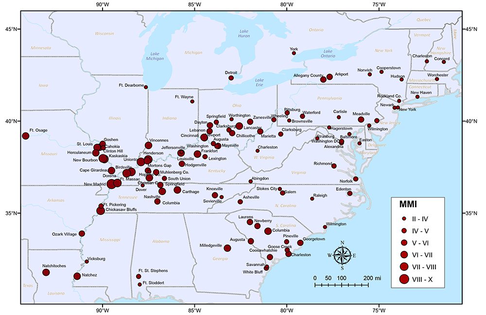
Far Field Reports MMI Map for Dec 16 1811 Earthquake

Click the map for a larger version
Far field reports are compiled from scanning surviving 1811-1812 newspapers for reports about the New Madrid earthquakes and associated effects. The information consists of the report, a synopsis of the report, and a brief commentary on the value of the report and its relationship to other accounts.This section is updated periodically as new information is found. Currently newspapers south and west of the State of New York have been searched. From these reports a map has been generated to depict the locations of the felt reports. This map is a representation of the location of those felt reports and the Mercalli scale value that was noted at those locations. This map is provisional and is subject to change as more data is found.
